The conquest of Granada in 1492 meant the changing of the border with Islam to the coastline. Therefore, it was the main basis for the reinforcement of the defence and protection of the Spanish territory due to the instability of the Moorish and the proximity of the North of Africa from where pirate attacks has constantly taken place.
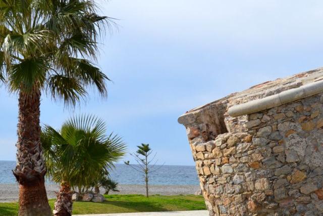
The Fortress of Carchuna. Built around 1775, it is almost similar to the ones found in La Herradura and Varadero (this last one already destroyed). It is a building of masonry and brick which was used to protect the area from constant pirate attacks and give home to the infantry and cavalry.
Leaning Tower (the Farillo). It was built on the sand of the beach. This is the reason why it has gradually been sinking and leaning, and now only half of the tower can be seen. In 1739 it was already built but we do not know the exact date of its construction.
Bigotes Cave. It is an Arab fortress built inside the cavity of a cave and it is only half of a tower. It has 12 metres of height and you can access to its three interior floors by some masonry stairs.
Starting from the car park opposite the fortress of Carchuna. The path goes along to the east along the road parallel to the coast, crossing the Rambla Rejón and leaving its left large areas covered by greenhouses and some residential areas. Less than a kilometre crossing over the rambla, and walking along the beach, we find the Farillo (the leaning tower).
Just after the Farillo, going along the beach, you realise that the coastline goes toward the northeast.
The path continues along beach of Calahonda until you pass in front of the church of this village. At this point the path forks, going along the beach, you will approach on foot to the cliffs.
Back near the church of Calahonda, take the street crossing the N-340 road, on the road that runs along the bottom of the cliff (Camino del Puntal). After walking half kilometre along the bottom of the cliff, you will finally reach the end of the path, next to the Bigotes Cave.
Information panels "Coastal flora of Carchuna" and "Litoral Arrow Calahonda".
In front of the sea, in the car park located in the Fortress of Carchuna.
Near the “Bigotes Cave” that it is located around half kilometre crossing the national road N-340, in the path which goes along the cliff (Camino del Puntal).
Visit the Fortress of Carchuna, recently restored.


